
 Literature
The Lord of the Rings is one of the great fantasies of all human history. It sits alongside the greatest classics in its influence. Tolkien is a pioneer of fantasy fiction in both literature and film. He was also an early whistleblower against the environmental destruction of the Industrial Revolution.
Readers may picture Middle-earth as a land born entirely from imagination, a patchwork of ancient myths and folklore. Yet “Middle-earth” is really just a retelling of “Earth.” In the summer of 1911, a young J.R.R. Tolkien hiked through the Bernese Alps of Switzerland. The journey left quite an impression and, decades later, those same mountains would reappear in the pages of The Hobbit and The Lord of the Rings. Here’s the story of his journeys.
On Foot from Interlaken
In the summer of 1911, Tolkien joined a party of twelve for a walking tour through the Swiss Alps. He was nineteen and due to begin at Oxford that autumn. More than fifty years later, the journey remained unusually vivid to him. He would trace Bilbo’s crossing of the Misty Mountains back to the adventures of that summer.

The group traveled mainly on foot from Interlaken, carrying heavy packs and avoiding the main roads. They sometimes slept in haylofts or barns, then cooked a small breakfast before setting out again. Tolkien remembered Lauterbrunnen and Mürren, the Scheidegg passes, Grindelwald, Meiringen, the Grimsel Pass, Brig, the Aletsch Glacier and Zermatt. The summer was exceptionally bright and dry, a season of almost continuous sunshine that made snow, stone and dark forest appear with exceptional contrast.
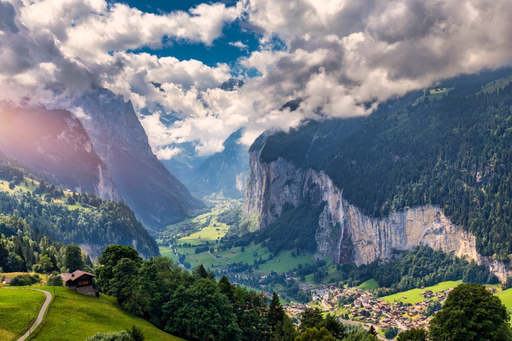
Lauterbrunnen and Rivendell
Tolkien connected the 1911 trip with Bilbo’s journey from Rivendell across the Misty Mountains. Scholars including John Garth have read Lauterbrunnen as a likely visual source for Rivendell: the valley’s cliffs and waterfalls are in line with Tolkien’s vision.
See Tolkien’s 1937 watercolour “The Fair Valley of Rivendell” →
 On the map Lauterbrunnen Valley →
Across the Two Scheidegg Passes
From the Lauterbrunnen side, Tolkien recalls turning east over both Scheidegg passes, with the Eiger and Mönch beside the party. The geography points naturally across Kleine Scheidegg into Grindelwald, then over Grosse Scheidegg towards Meiringen. Here the real Alpine road begins to feel like the passage over the Misty Mountains: high passes, immense rock walls and the next valley always hidden beyond the ridge.
Silberhorn and Celebdil
One Swiss association was named by Tolkien himself. He left the Jungfrau view reluctantly: permanent snow seemed cut against permanent sunlight, while one smaller summit rose sharply against the blue:
“The Silvertine (Celebdil) of my dreams.”
Celebdil is the peak above Moria where Gandalf’s fight with the Balrog ends. Within the white Jungfrau massif, it was the jagged Silberhorn that became the mountain of Tolkien’s dreams rather than the higher, more famous summits.
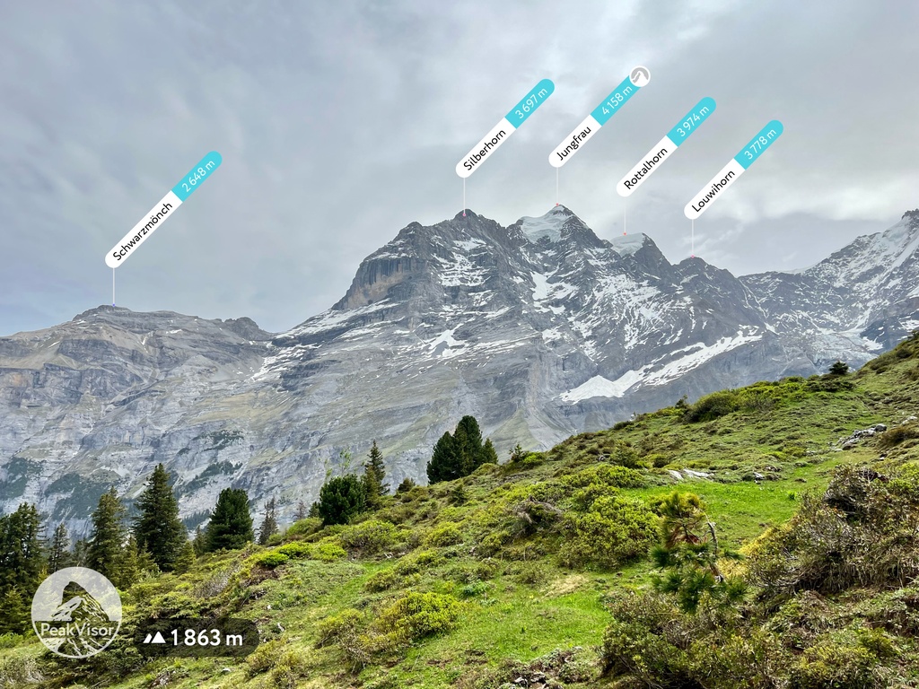 On the map The Silberhorn, Tolkien’s Silvertine →
Meiringen, Grimsel and Brig
After Meiringen, the next firm waypoint in Tolkien’s account is the Grimsel Pass. The party crossed into Valais, descended to the dusty road beside the Rhône and continued on foot.
Brig survived in Tolkien’s memory as a sound: the persistent screech of trams. After just one night in town, the walkers next climbed several thousand feet towards a village and chalet inn below the Aletsch Glacier.
On the map Meiringen · Grimsel Pass · Brig →Belalp and the Aletsch Glacier
Tolkien did not name the chalet village in his surviving account. Scholar John Garth identifies it as Belalp, a convincing fit for the climb from Brig and the village’s perch below the Aletsch.
Above the Aletsch Glacier, the party crossed a slope where heat had loosened stones and boulders. Rocks gathered speed across the narrow path and plunged into the ravine; one shot between Tolkien and the walker just ahead of him.
The episode may have inspired the stone-giants in The Hobbit, turning a moment of danger into part of the landscape of the Misty Mountains.
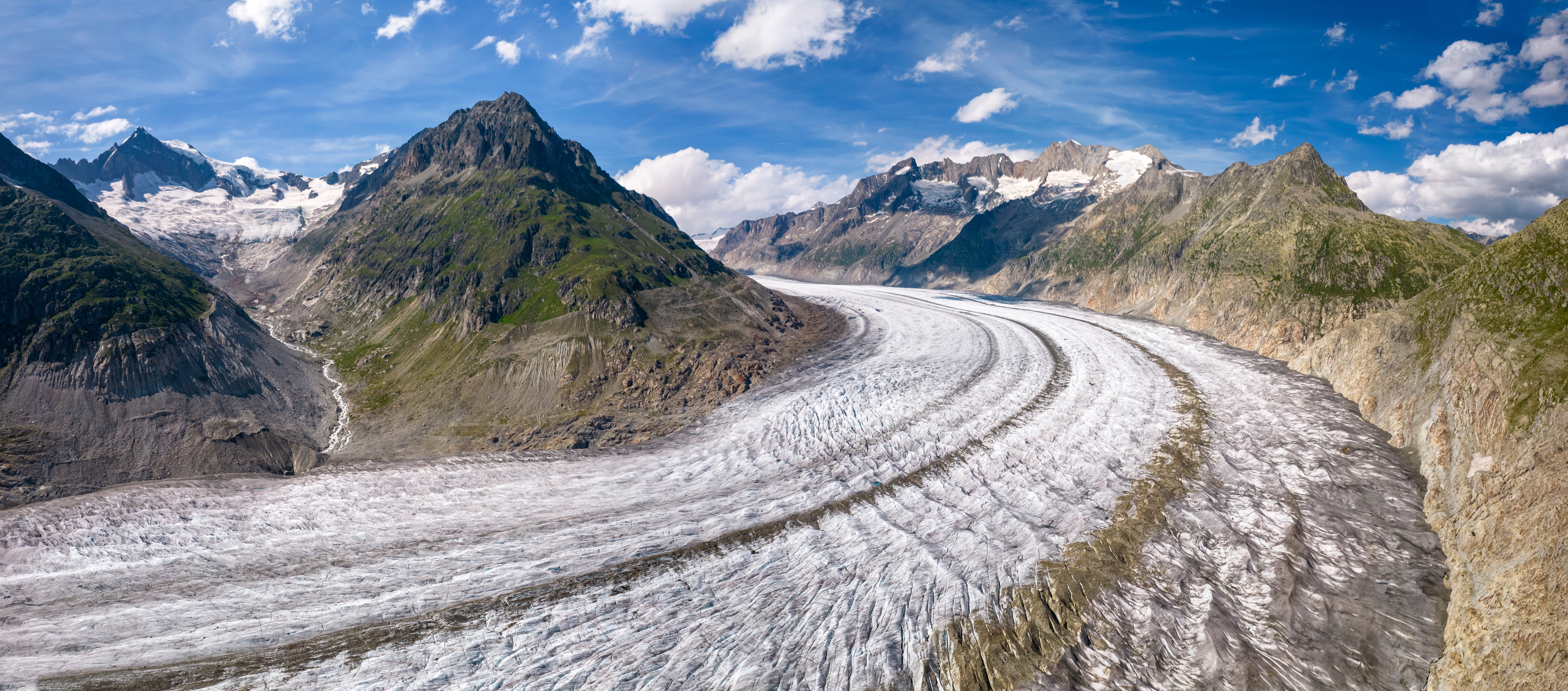 On the map Belalp and the Aletsch Glacier →
Zermatt and the Black Horn
After the Aletsch stage, order began to subside as exhaustion set in. The party eventually arrived in Zermatt in a dusty, depleted huddle. Elegantly dressed visitors gazed at them disapprovingly through lorgnettes.
From Zermatt, Tolkien recalls climbing roped with guides towards a high Alpine Club hut (he later mentions that the rope might have prevented him from falling into a crevasse). He later wrote:
“The dazzling whiteness of the tumbled snow-desert between us and the black horn of the Matterhorn.”
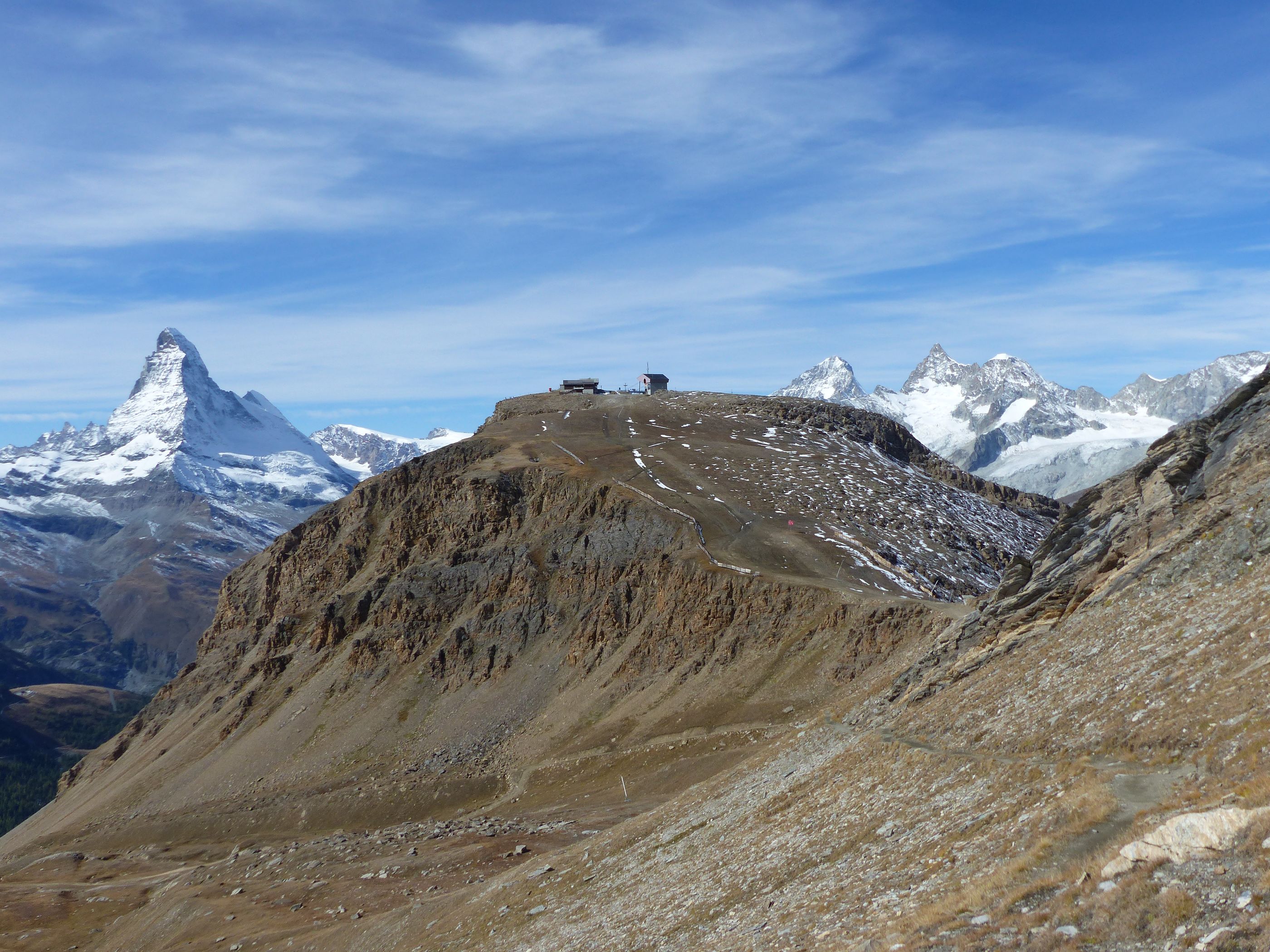 On the map Zermatt →
How a Journey Becomes a Story
Tolkien did not turn Switzerland into Middle-earth by re-hashing his journey. What remained were the physical truths of a long adventure in the mountains. The weight of a pack, a pass hiding the next valley, loose stones gathering speed, sudden changes from sunlight to shadow, a distant, unknown summit. Decades later, those sensations contributed to a new fantasy, one that would capture the hearts of tens of millions of readers worldwide.
What the Map Can Show
The line on our map is not a recorded GPX track from 1911. It’s a modern reconstruction of the section from Interlaken towards Zermatt, drawn through the places Tolkien named and the passes that connect them.
Kleine and Grosse Scheidegg are topographic identifications; Belalp is a scholarly attribution; the later stages, whose order Tolkien remembered less clearly, are omitted. The map does not claim to reproduce every footpath or assign each stop a Middle-earth equivalent. It is historical orientation rather than a route for navigation.
Historical reconstruction Open the reconstructed route from Interlaken towards Zermatt →